US-Disaster: Die Zollkarte / Tariffs Map https://geoobserver.de/2025/04/04/us-disaster-die-zollkarte/ #Tariffs #Map #gistribe #gischat #fossgis #foss4g #OSGeo #spatial #geospatial #gis #geo #geoObserver pls RT via @mapadenoticias
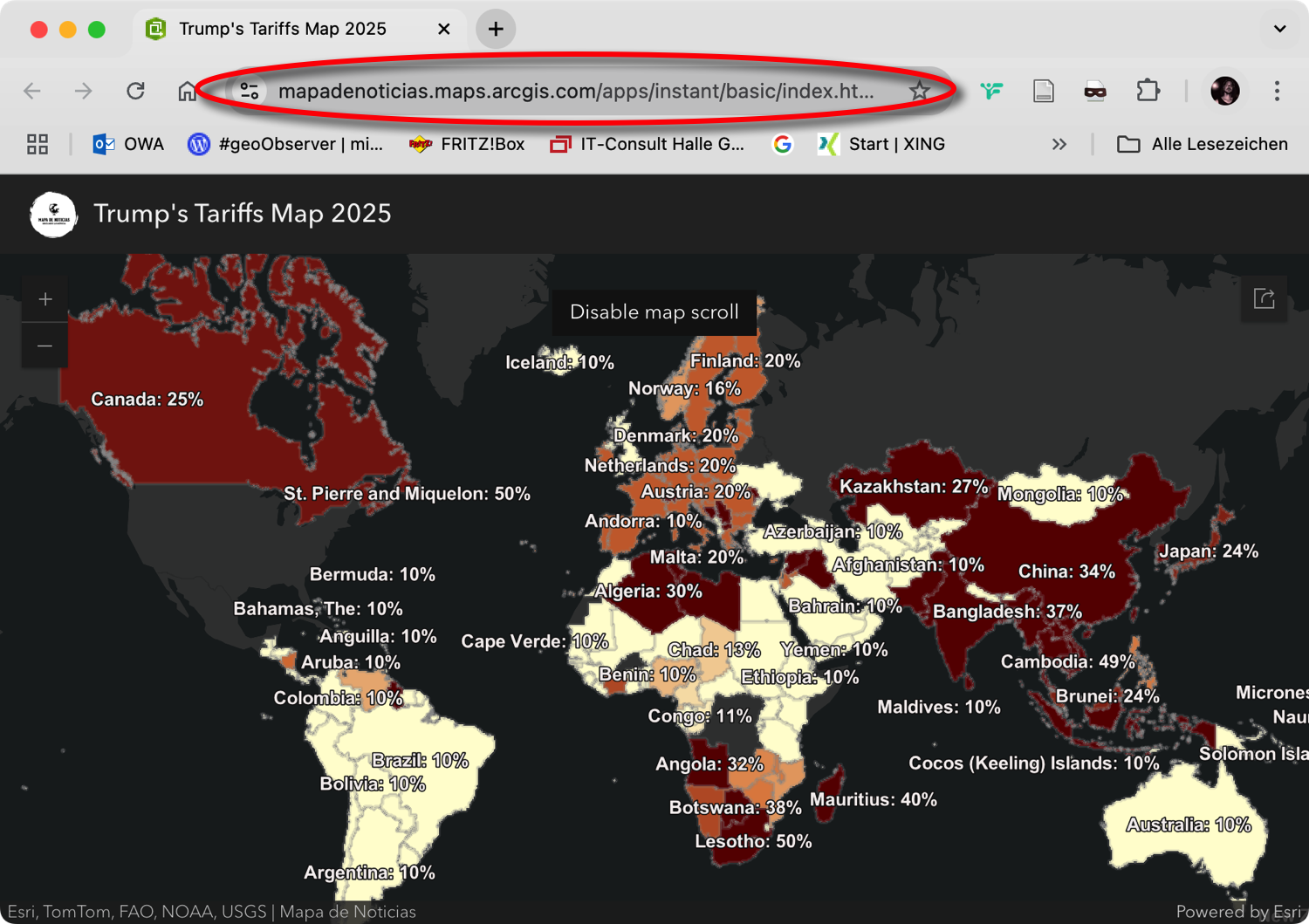

US-Disaster: Die Zollkarte / Tariffs Map https://geoobserver.de/2025/04/04/us-disaster-die-zollkarte/ #Tariffs #Map #gistribe #gischat #fossgis #foss4g #OSGeo #spatial #geospatial #gis #geo #geoObserver pls RT via @mapadenoticias
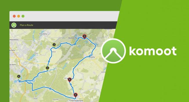
#BendingSpoons is a #PrivateEquity firm. #Komoot #bike users should download their already ridden or planned #tracks as #GPX files as soon as possible before they have to pay a lot for them (or even to get a #map update). Better alternatives to Komoot: #Routing with #Brouter , #Cyclers , #VisuGPX or #Valhalla ; (free) navigation with #OrganicMaps or #CycleTravel . Everything else (photos, etc.) is anyway a #socialmedia feature.
#BikeTooter #fahrrad #vélo #cyclotourisme
https://road.cc/content/news/job-cuts-expected-komoot-after-tech-firm-purchase-313159
I just realised we own an up-to-date map (march 31, 2025) showing locations of all McDonald and Burger King franchises in Greenland.
Hoping it stays up-to-date for many years to come.
.
Hand colored atlas page showing the arctic polar regions.
edit: that is indeed a high speed rail connection from the top-left of the planet to the polar center. Wooden sleepers though, it's the 1600s.")
#OTD March 30 in 1853, artist Vincent van Gogh was born. He would create over 800 oil paintings before his death at the age of 37.
Click the link to find on a #map where he was born?
https://www.whereintheworldgame.com/?id=27&type=q

#Map Art or Scientific Cartography?
https://www.geocurrents.info/blog/2025/03/27/map-art-or-scientific-cartography/
What's a good map application that meets the following requirements?
* It works _both_ on the browser and on the phone.
* It supports walking and driving navigation.
* It allows to save places and see those saved places on the map.
* Based on OpenStreetMap data.
That's it. Those are all my requirements! 
Thank you!
A physical geography map that represents different landforms & water bodies found on Earth. It labels various geographical features - mountains, valleys, rivers, deserts, islands & peninsulas - making it to a great educational reference for Earth’s terrain.
From what I understand, it appears to be accurate in terms of geographical terminology.


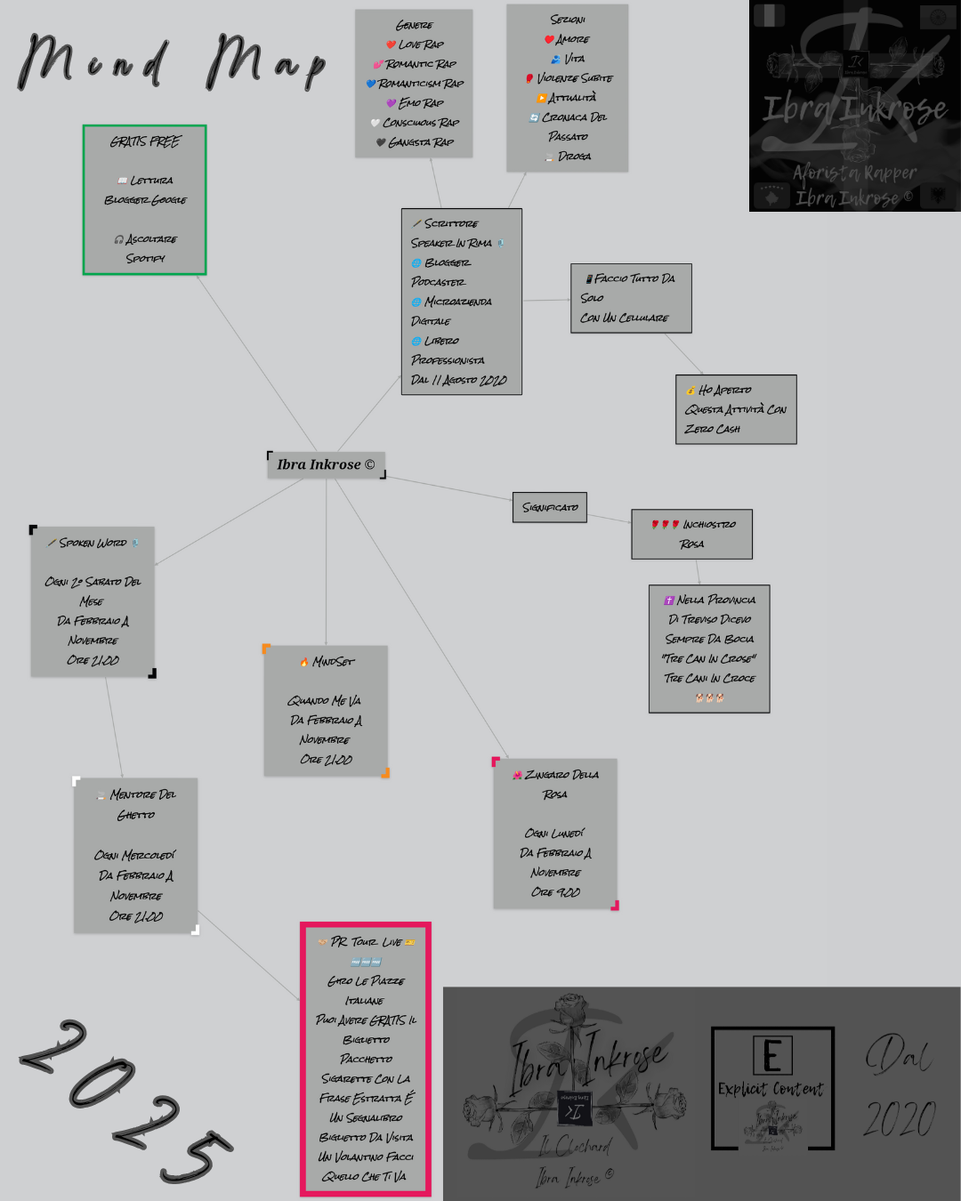
Scrittore Speaker In Rima
Blogger Podcaster
Libero Professionista
Microazienda Digitale
Dal 2020
#motivation
#mind
#map
#libertá
#freedom
#blogger
#blog
#scrittore
#scrittura
#scritturacreativa
#speaker
#motivationalspeaker
#spokenword
#aforisma
#aphorism
#pensiero
#mindset
#ibrainkrose
#freedom
#perugia
#OTD March 14th in 1879, scientist Albert Einstein was born. His most famous contribution to science was developing the theory of relativity. He moved to the US in 1933 to flee fascists.
Click the link to find on a #map where he was born:
https://www.whereintheworldgame.com/?id=43&type=q

When I started mapping the first additions in the OsmaAnd app for Openstreetmap at the end of 2015, I never thought I would make 1 million changes. Entered in OsmAnd and then in Potlach2 (because it was beginner-friendly). Then later iD and other apps. Like Mapcomplete, Streetcomplete or Everydoor. 1
I can only recommend just getting started.

RELEASE: Greater Northshore and MEGAMAP Bike Maps version 1.5.1 - 8 March 2025
Additions and changes this release:
* WATERFRONT TRAIL now open in Downtown Seattle. This is a small section opening, but it is an important connection
* HONEY DEW CREEK TRAIL in Newcastle/Renton. Turns out it's a popular paved shortcut
* Better road name markings a few places
* Warnings on 15th Avenue S bike lanes which are now _closed_ now 'til spring
https://github.com/solarbirdy/NorthshoreBikeMap/
Previous permalinks continue to work.
If you like these maps, maybe hit my Patreon:
https://www.patreon.com/solarbird
Thanks!

#OTD March 4th in 1918, the first official case of the 1918 (Spanish) flu was recorded.
Click the link below to find on a #map where this first case was recorded (hint - it was not in Spain):
https://www.whereintheworldgame.com/?id=194&type=q

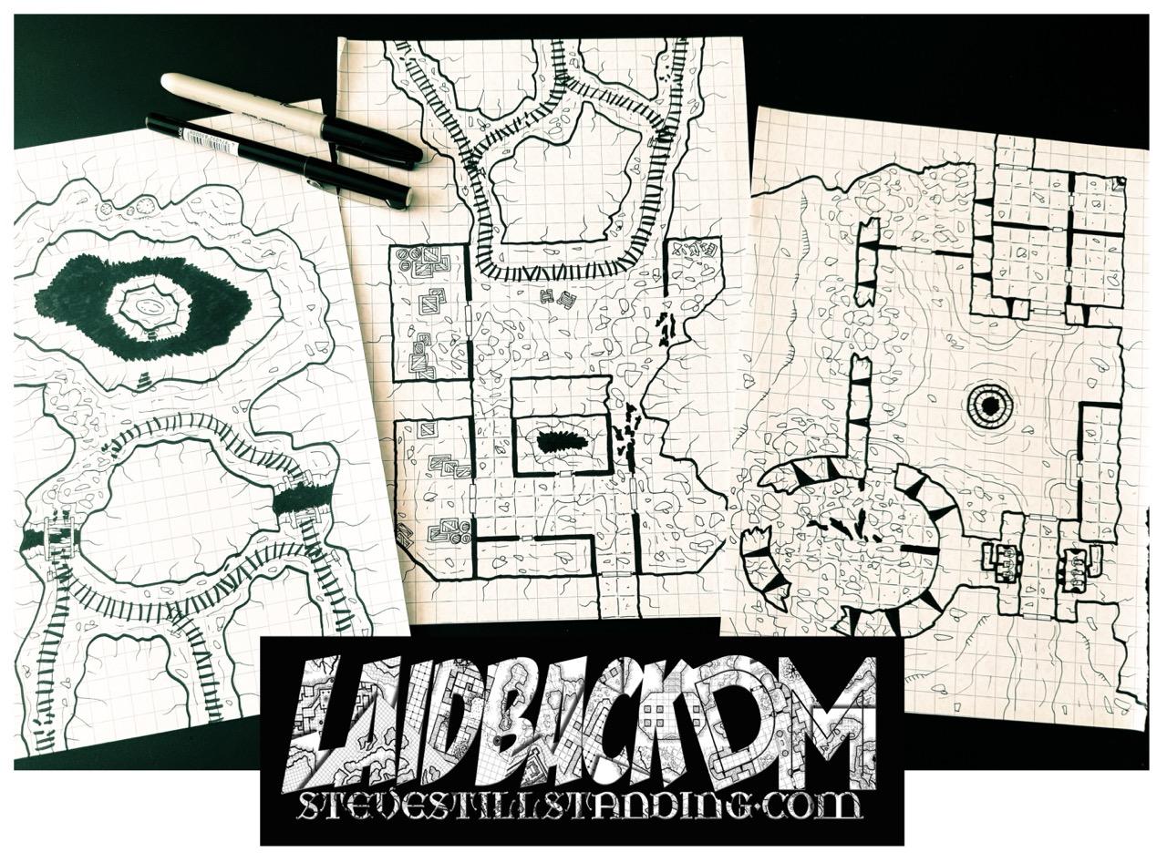
3 new #handdrawn #maps I drew today. I videoed each of them, so I’ll debut them on #TikTok & #YouTube over the next few days 

 **The United States of Europe: a peculiar history of European federalism**
_“A journey through some of the most peculiar ideas for federating Europe in the 20th century, by Maas, Kohr and Heineken.”_
 https://www.cartographerstale.com/p/the-united-states-of-europe-a-peculiar.
#History #Map #Maps #Cartography #Europe #Histodon #Histodons @histodon @histodons
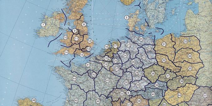
"In 1962, the Democratic German Report, an English-language journal based in the #DDR, published a #map listing the countries in which former members of the #Nazi party were working as ambassadors for the Federal Republic of #Germany. Despite the end of the Third Reich’s reign of terror, the ‘old elites’ quickly re-emerged in the young Federal Republic. Functionaries of the #Hitler regime were appointed to influential positions in the judiciary, universities, the army, and corporations."
#cartography
https://ifddr.org/en/studies/studies-on-the-ddr/risen-from-the-ruins/
![World Map with country names and the legend "[Icon swaztika] West German ambassadors who were members of the Nazi Party
[Icon losange] West German ambassaders who worked in Hitler's Diplomatic Service
[Icon circle] West berman ambassadors who held important jobs in Hitler Germany".](https://post.lurk.org/system/media_attachments/files/114/069/584/804/334/455/original/1980f0f8a0ba9ce0.png "World Map with country names and the legend \"[Icon swaztika] West German ambassadors who were members of the Nazi Party
[Icon losange] West German ambassaders who worked in Hitler's Diplomatic Service
[Icon circle] West berman ambassadors who held important jobs in Hitler Germany\".")
3 new #handdrawn #maps I drew today. I videoed each of them, so I’ll debut them on #TikTok & #YouTube over the next few days


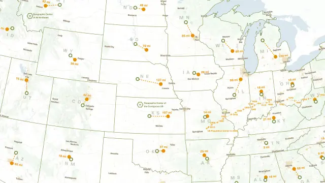
→ Mapping the Middles of the United States
https://www.maps.com/mapping-the-middles-geographic-center-us/
“The population center of the US has shifted considerably, moving from the East Coast in 1790 to southern Missouri by 2020.”
“[T]his #map demonstrates how that [middle] concept takes center stage in #geography. Whether by the inescapable march of time or the numerous ways we conceptualize and categorize the #world around us, there’s always more than one way to measure—and map it.”
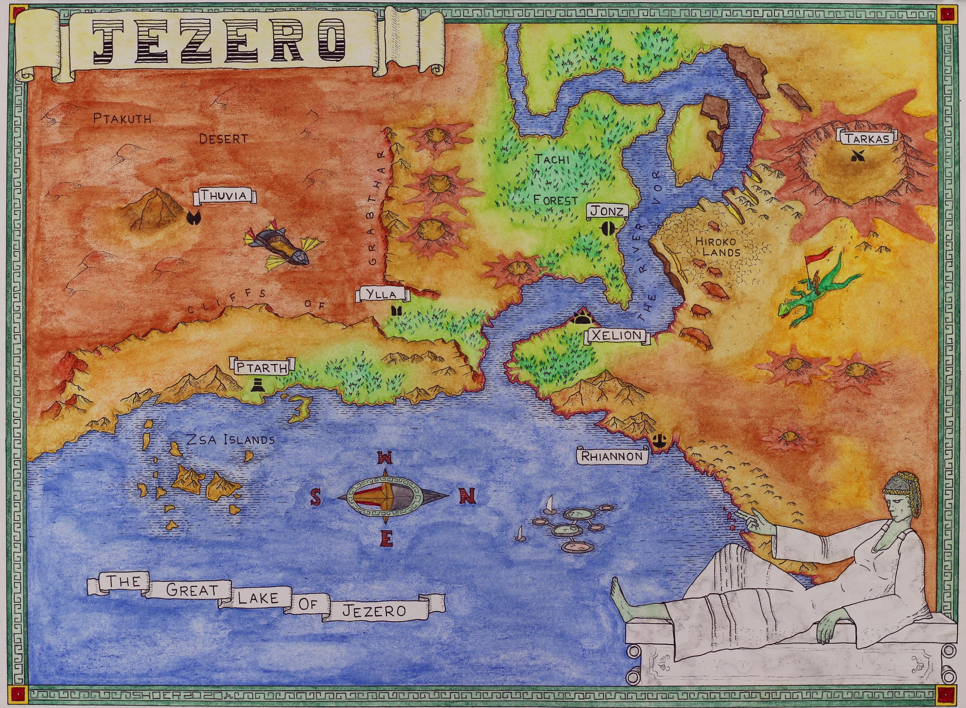
@AkaSci I drew this #map in honor of #Perseverance's mission. It's from a different perspective and much of the rover's journey is under the ancient lake, but it covers much of the journey so far.
This week in 1847, the first rescue team reached the famed Donner Party, which had been trapped by snow at a campsite for nearly four months. Of the original 87 members of the Donner Party, 48 survived.
Click the link to guess the location of where the Donner Party was trapped for four months:
https://www.whereintheworldgame.com/?id=193&type=q